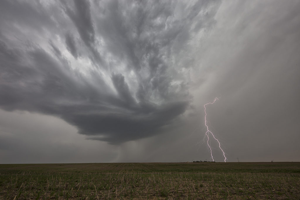
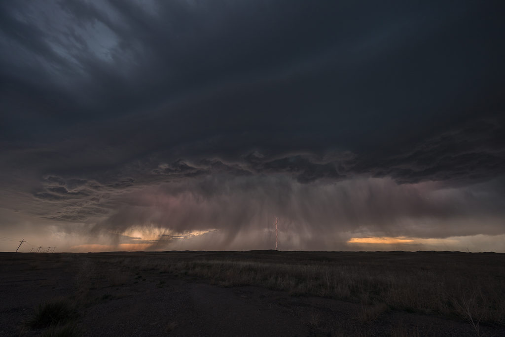
June 13th was the last chase day for the next week as a massive ridge of high pressure dominated the western 2/3 of the US. Fortunately we were able to catch a few severe storms/marginal supercells in western Nebraska north of Alliance. Good CAPE, but marginal shear would let these storms become a cluster of outflow dominant storms late in the day. However they were quite electrified, before gusting out near Hemingford, Nebraska. Fun day, with 80mph winds, golfball sized hail and some pretty scenery to watch these storm do their thing! Enjoy the pics!
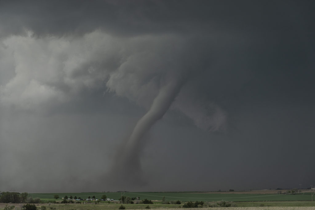
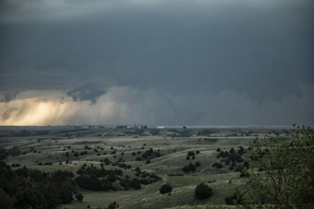
June 8th Central Nebraska Tornadic Supercells
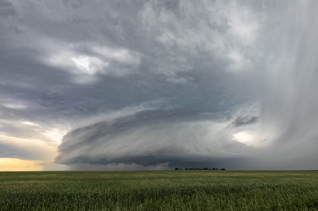
June 8th would provide us with ample opportunities to intercept numerous severe thunderstorms in central Nebraska. By mid afternoon several intense supercells formed along a weak front. Two storms became tornado warned as they spun across the region near Anselmo. Strong shear, decent moisture, high CAPE values and the boundary provided the focus for storms. We caught the first storm as it spun across with a large wall cloud that was rotating steadily but slowly. It tried to produce a tornado but never could. The second cell was by far the prettiest of the day. It had fantastic structure, a very large wall cloud and a couple of weak spin ups. At one point a dusty debris cloud formed underneath a small funnel that touched down for about 1-2 minutes. The storm became a formidable supercell and it moved across the region. Several other storms formed and a couple were also tornado warned, but did not produce. A fun and exciting day with these cells for all tour guests! Enjoy the pics and please click on one for a larger image.
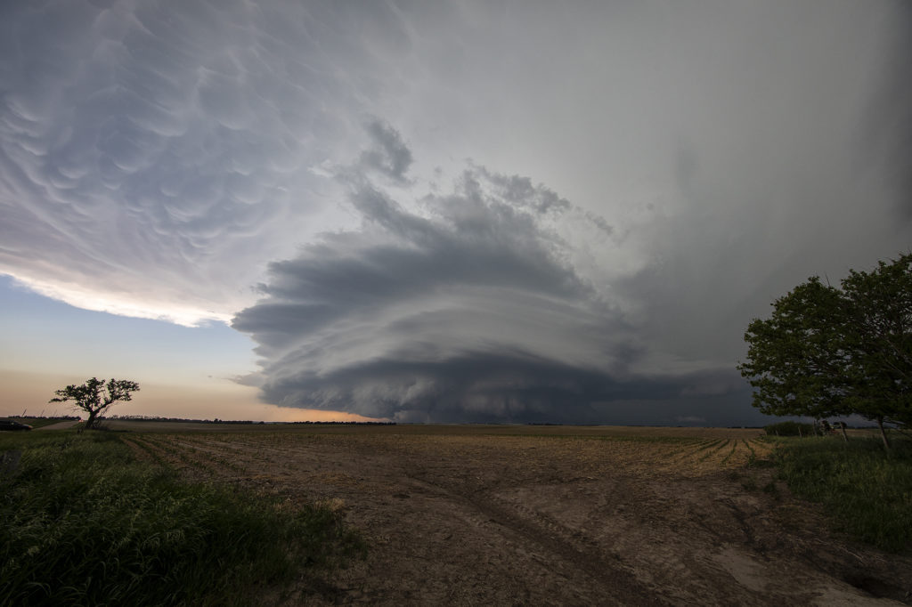
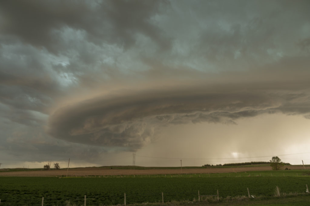
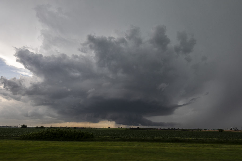
May 27th Northeast Colorado/Southwest Nebraska Tornadic Supercells
This day had a lot going for it. Great shear, good moisture and instability, and a dryline would help set the stage for intense supercells. Our first storm of the day formed near Ft Morgan and tracked northeast along I-76. It became a rather large and occasionally disorganized supercell. However as it approached Sterling, it wrapped up hard and produced a brief, small tornado. Further to the east, a second, well organized and photogenic supercell formed. It produced a few brief tornadoes, however the structure of this storm would be one of the prettiest for 2019! As it came towards Imperial, a beautiful sculpted storm was present. At one point west of town, not only did the storm have a stunning appearance, but a partially rain wrapped tornado became visible. The cone shaped twister was on the ground for a few minutes before wrapping in rain again as we lost visibility of it. An amazing day with gorgeous storms and a few tornadoes! Enjoy the photos below!
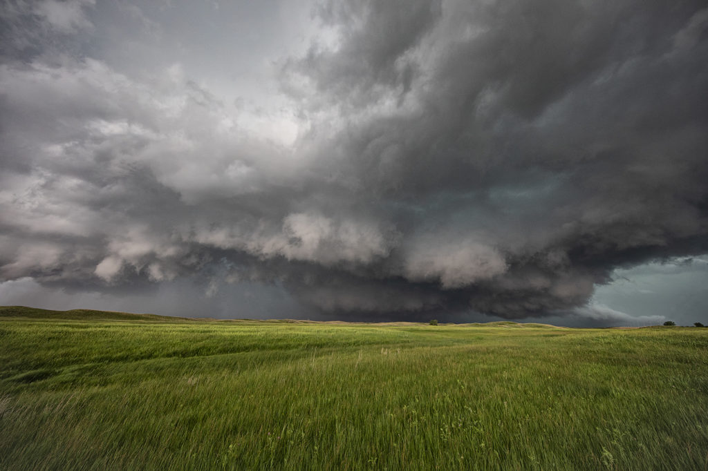
May 17th Southwest Nebraska Tornadic Supercell
May 17th was an amazing day. Storms formed along a dryline in northwest Kansas and northeast Colorado and pushed into southwest Nebraska. One supercell approached McCook, NE and dropped a few tornadoes along the way. Strong wind shear, great instability and good surface moisture set the stage for this and other storms to form. The first tornado was quite pretty as it tracked just west of town. A couple more formed in the hills where roads were bad and thus not greatly visible from where we had to intercept them. None the less the storm was a very pretty supercell and long lived. It persisted for several hours before weakening north of Kearney, Nebraska.
May 16th North Platte, Nebraska Supercell
May 16th was the day before the big day. Limited moisture would cause storms to be higher based, thus increasing the wind threat as well as hail. However little tornado threat would occur. We intercepted a cluster of storms which would move northeast towards North Platte and become severe. Hail to golfball size, pretty structure and intense lightning would occur from these. The tail end cell broke off from the line and became a pretty supercell right at sunset. The colors, structure and lightning were very pretty! Enjoy the photos below!
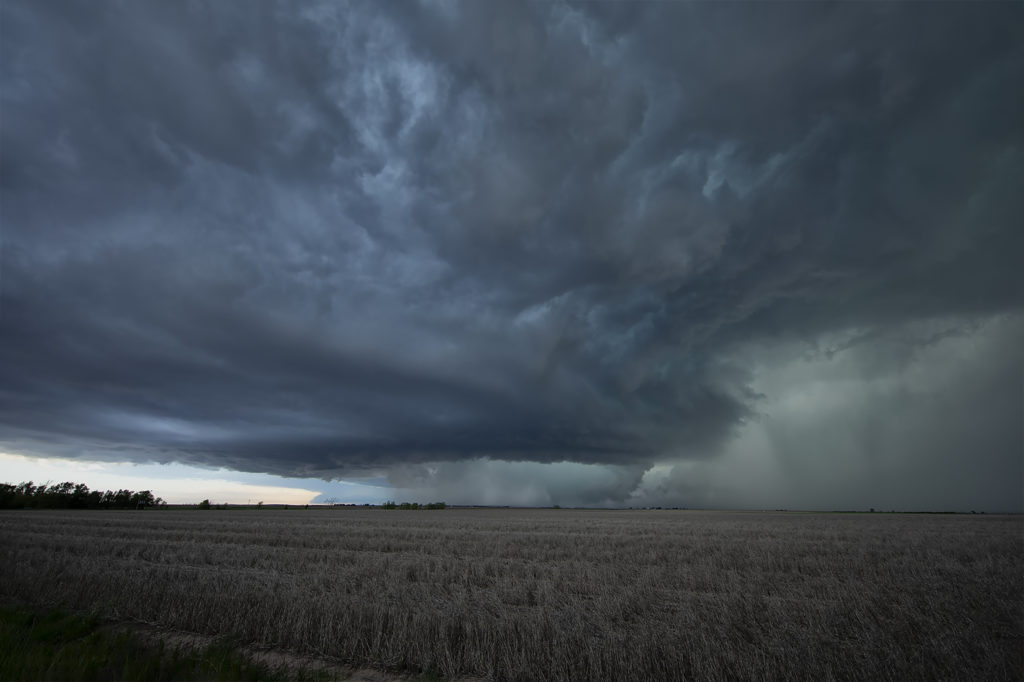
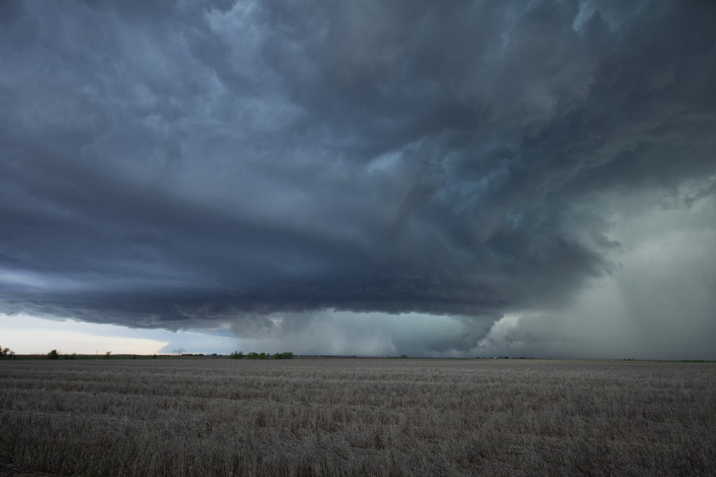
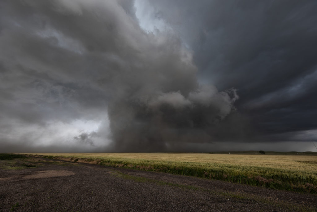
June 17th Colorado/Nebraska Tornadic Supercells
June 17th had big promise. Great wind shear, good moisture, high CAPE and a dryline and outflow boundary intersection set the stage for what would be a great day! We started in Ogallala, Nebraska and just had to drift westward towards northeast Colorado. Mid afternoon initiation was pretty convincing that supercells and possible tornadoes would occur. The initial supercell spun like mad, dropping baseball sized hail and producing at least two tornadoes. Structure was very pretty, however blowing dirt in the rear flank downdraft area (rfd) would block viewing of the mesocyclone at times. A big dusty tornado occurred near Julesburg, CO followed by another tornado near Big Springs, NE. The cell would eventually gust out northwest of North Platte, NE but not before producing one more small tornado. A fantastic day that produced an awesome supercell. Meanwhile, SLT co-owner Caryn Hill chased locally and intercepted a highly sculpted tornado warned supercell near Otis, Colorado! Probably the best structure for 2018 to that day! Enjoy the photos!
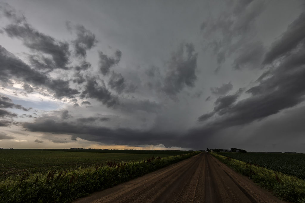
June 11th Eastern Nebraska Tornado Warned Supercell
June 11th featured very high surface moisture and extreme instability. A boundary laid across eastern Nebraska and would be the focal point for severe and tornado warned storms this day. By mid afternoon, strong convergence along the boundary would result in rapid supercell development, with one storm in particular near Fremont, Nebraska becoming tornado warned. Shear steadily increased through the afternoon and caused this supercell to spin wildly! It produced a couple funnels, large hail and some wind damage! After a few hours, numerous storms formed and quickly developed into a linear MCS that marched across the area into western Iowa, becoming tornado warned periodically. A fun and exciting day for the tour that really wasn’t expected just a couple days before! The old motto of never give up holds true!!!! Enjoy the pics!
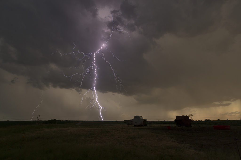
May 10th Southwest Nebraska Supercell
May 10th took us to western Nebraska for severe storms. Good instability and shear, as well as convergence along the dryline, would allow significant storms to form. However, due to lack of good deep moisture, the cells would be higher based than you would like to produce tornadoes. We intercepted a few storms this day, but the best and prettiest was a supercell that formed southwest of Ogallala, Nebraska later afternoon. This cell would have that classic mothership appearance, produce baseball sized hail and also became quite electrified. We were able to capture some great images. Also, we deployed our slow motion lightning camera which caught numerous bolts in slow motion!
Here’s a link to the lightning video:

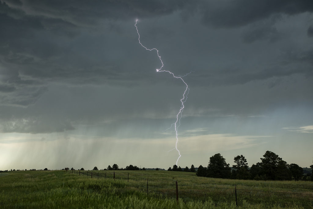
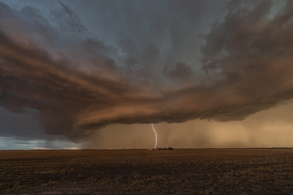
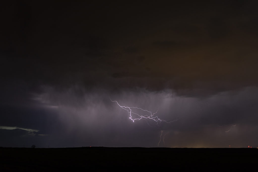
May 7th Valentine, Nebraska Electrical Storms
May 7th really didn’t have much going for it. It was the first day of Tour 3 and we wanted something to chase. We left Oklahoma City early bound for Valentine, Nebraska, some 650 miles away. Decent shear, but very limited moisture and instability would result in high based storms to form. What we didn’t expect was the amount of lightning that was occurring with these storms. Right around sunset they became quite electrified producing numerous cloud to ground lightning strikes. We pulled east of town as they became severe warned and watched the show. Very pretty and long lasting lightning display rolled on for hours.
Enjoy the photos!
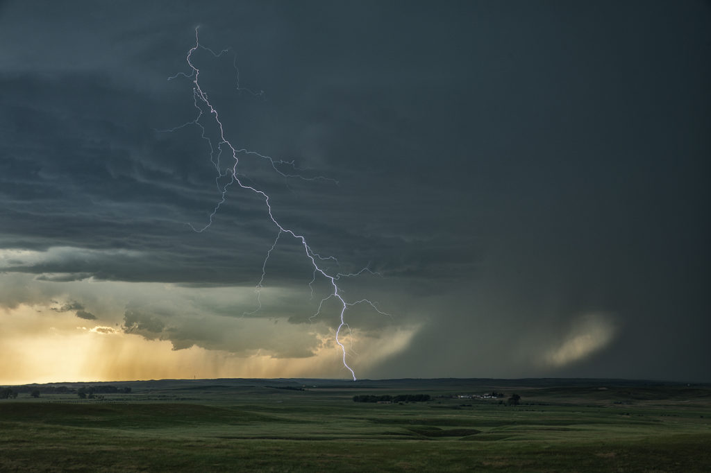
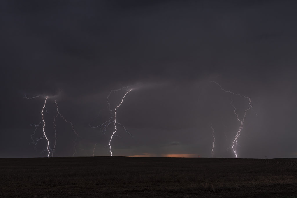
June 20th Southern Nebraska Lightningfest
June 20th took us to southern Nebraska. Excessive heat, steep lapse rates, moderate CAPE and moisture, as well as a local boundary across the I-80 corridor would set the stage for severe storms this afternoon and evening. Clusters of storms formed west of Kearney, NE and drifted south. Their outflows kicked up new storms ahead of them by early evening. Due to steep lapse rates and optimum freezing levels, the storms were incredibly electrified! Some of the best lightning of 2017 occurred that evening, well into the night time hours. We stayed in front of the cluster of severe storms into Kansas well into the night time hours. A great day for the lightning lovers! And who isn’t one????