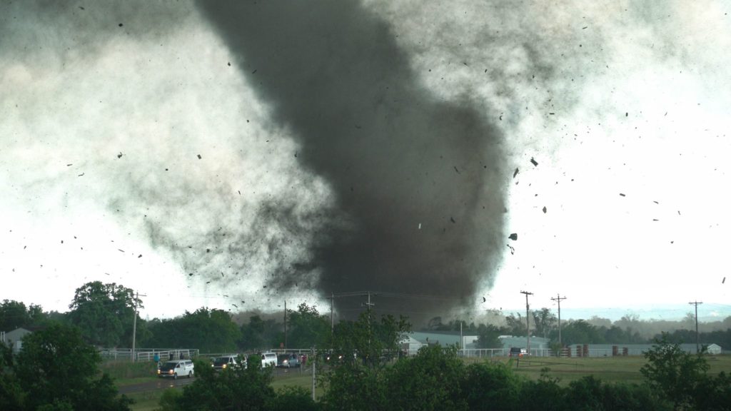
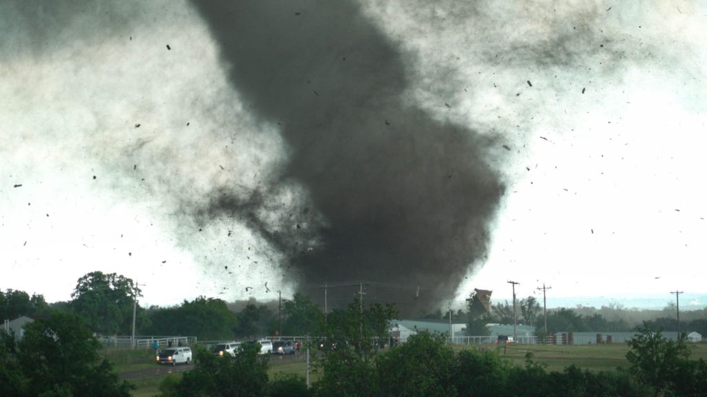
May 9th was one of the best days of 2016. Deep moisture, high CAPE values, great wind shear and strong lift along a dryline would generate several intense and tornadic supercells in central and southern Oklahoma. We positioned ourselves south of Pauls Valley as a persistent updraft was forming to our southwest. One supercell formed and anchored there and became tornado warned. However, it was the new updraft on its southern flank that would become the storm of the day. This updraft would become an intense tornadic supercell dropping an EF4, and 2 EF3 tornadoes along its path.
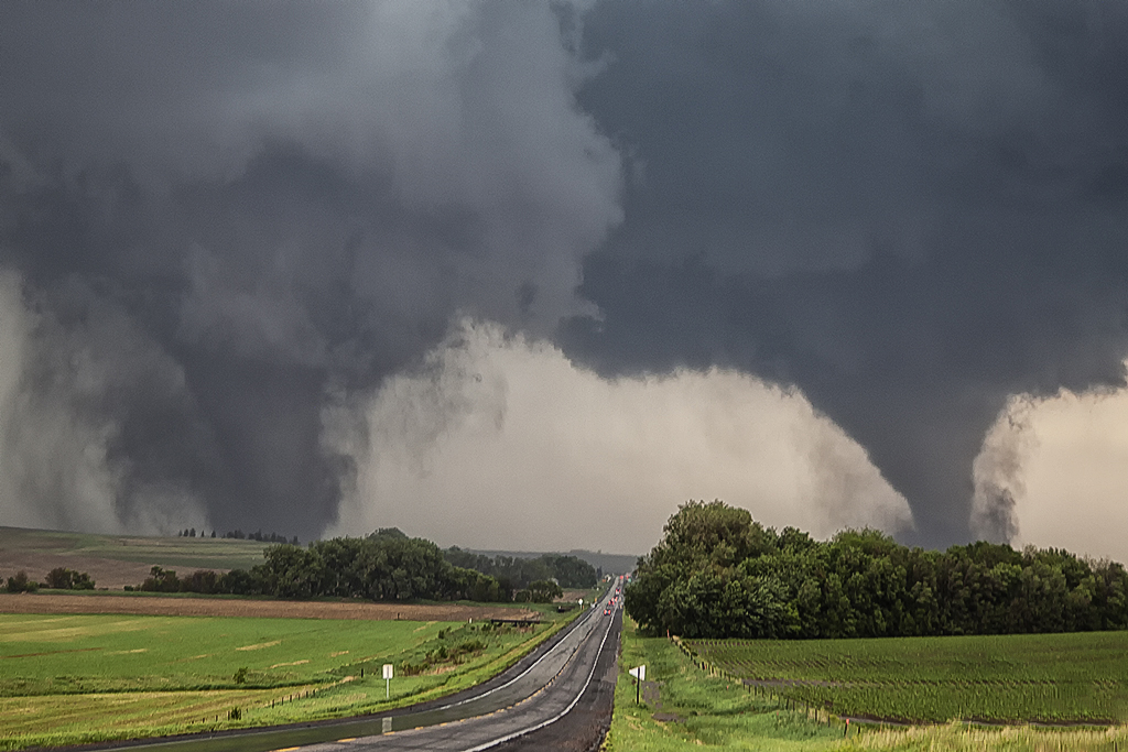
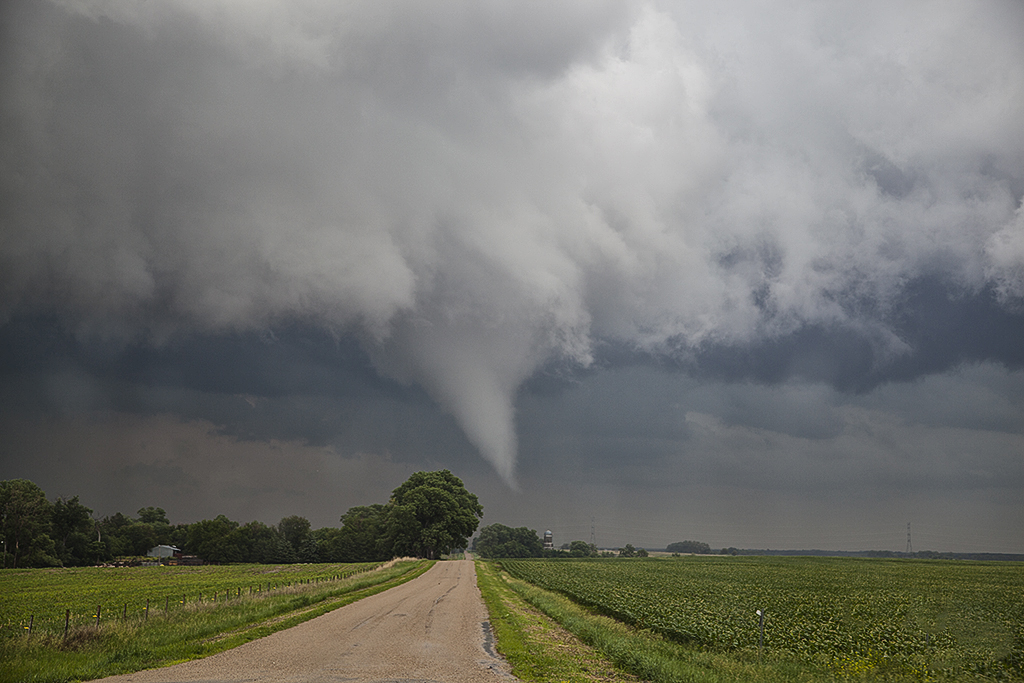
Our intercept of the very close and INTENSE EF4 Wynnewood tornado would be one our guests will never forget. A very predictable and fairly stable tornado would allow us to get very close to it, something we usually do on our Close Encounters tour. We were positioned a couple hundred yards north of the path of this tornado, and we flipped the vans around, ready to jump in and get out of the way should it make a sudden turn. It did not. It passed very close to us. You could hear the waterfall sound of the tornado as it ripped its way across the highway next to us. It would move east and dissipate near I-35. But this storm was far from done. A nearly mile wide tornado would develop and pass just north of Sulphur and an additional elephant trunk shaped tornado would form east. Both of these tornadoes were rated EF3. At the end of the day we would drop all the way south of the Red River into northern Texas as more supercells would develop and become tornado warned.
The photos of the vans in front of the tornado are courtesy of Hank Schyma !!! THANK YOU Hank!!!!
Our hearts go out to those who suffered losses this day.