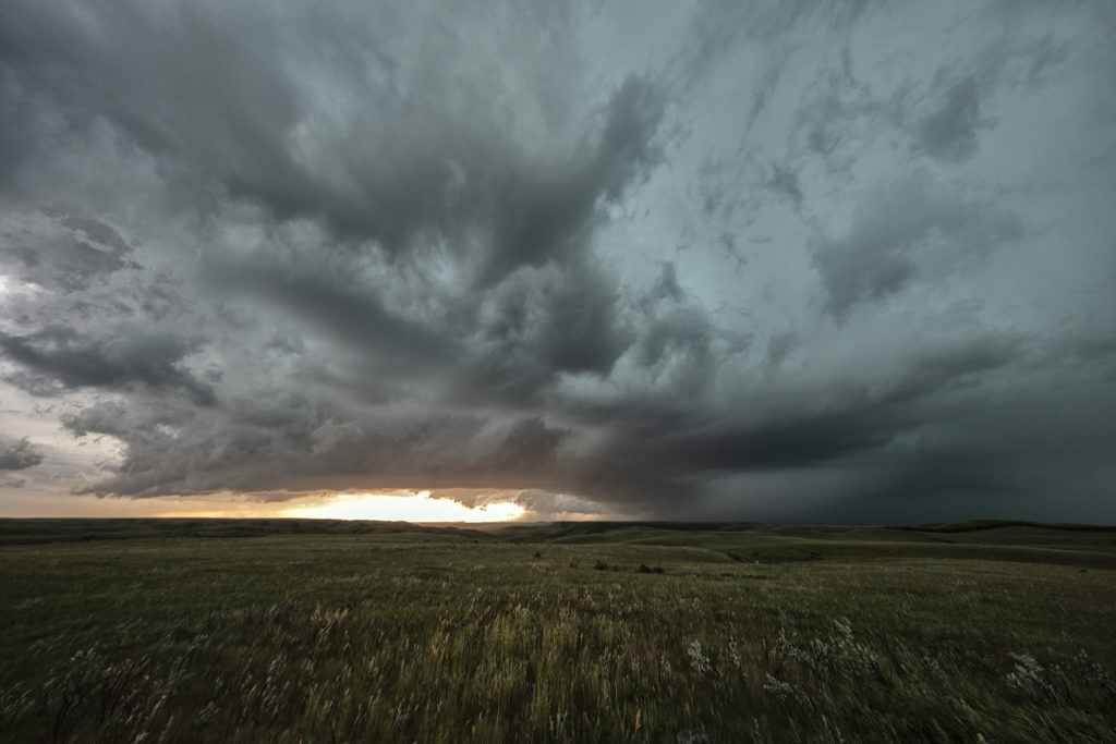
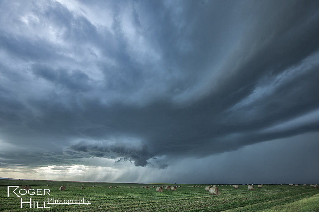
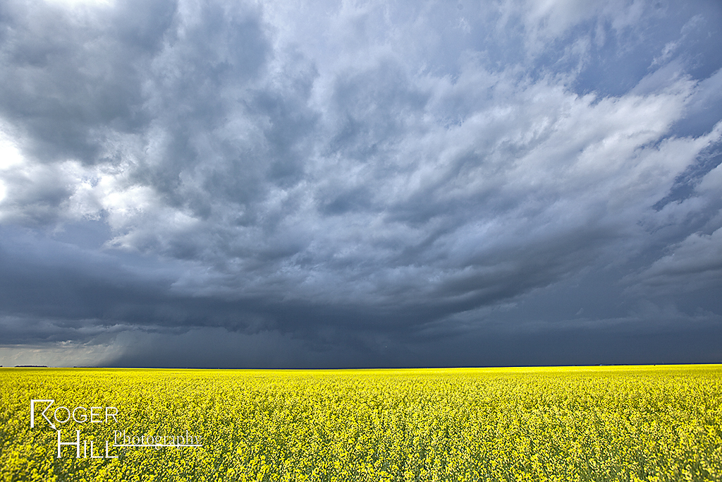
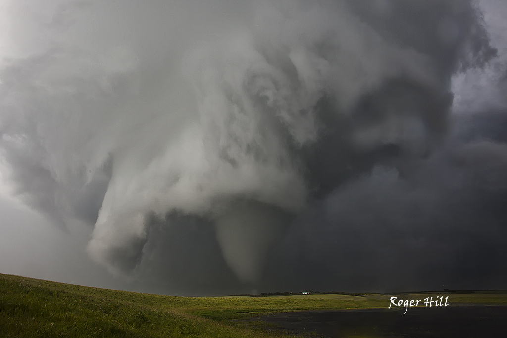
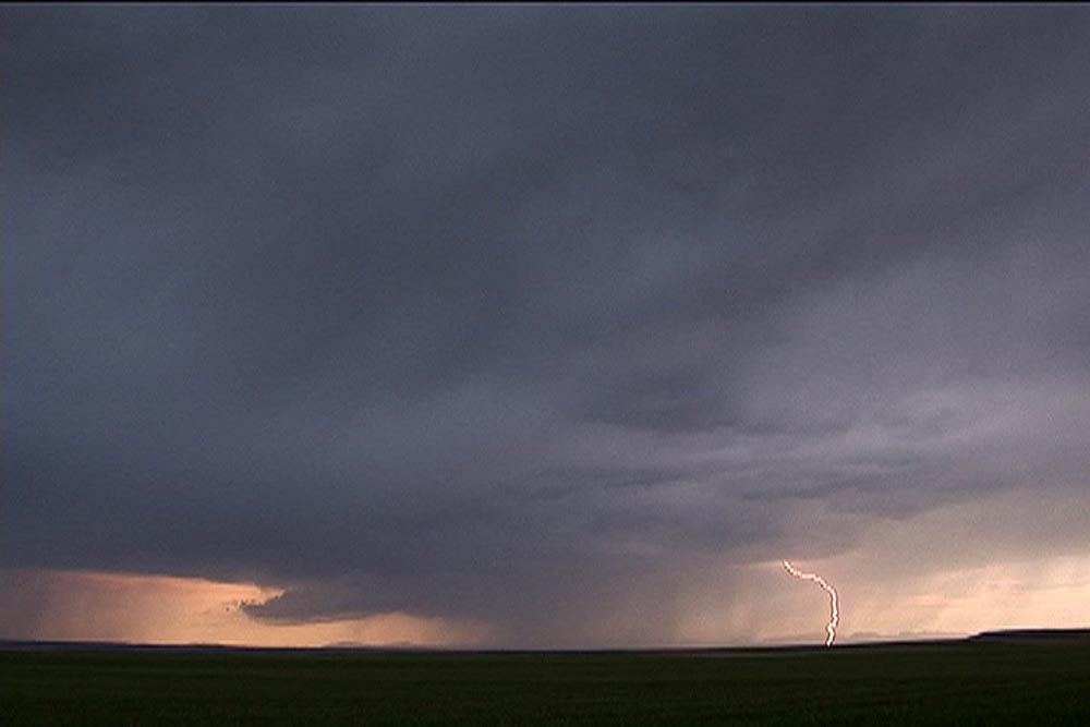
July 10th lived up to the potential forecast models showed! A strong shortwave trough would traverse across southern Canada and Montana, as a dryline/cold front and associated warm front would slide slowly east. Strong shear, deep moisture, high CAPE and several boundaries would be the focus on severe storms. The question would be whether or not they would be isolated or clusters/linear. Fortunately a cluster of supercells formed over southern Saskatchewan and the tail end cell anchored along the warm front west of Killdeer. This storm would become a tornado machine as it produced at least 11 tornadoes we counted. More may have occurred as multiple occlusions occurred and some were quite messy with low visibility. This was one of the best tornadic events we’ve witnessed in Canada in 20 years of tours! Fortunately the tornadoes stayed over rural countryside and did little damage. A couple of these were quite strong. This storm slowly moved east riding the warm front all the time and eventually was choked off by outflow from a linear complex over Montana. Amazing event and a great way to end our tour season! Enjoy the photos and video stills!
July 13th Central Alberta, Canada Tornadic Supercell
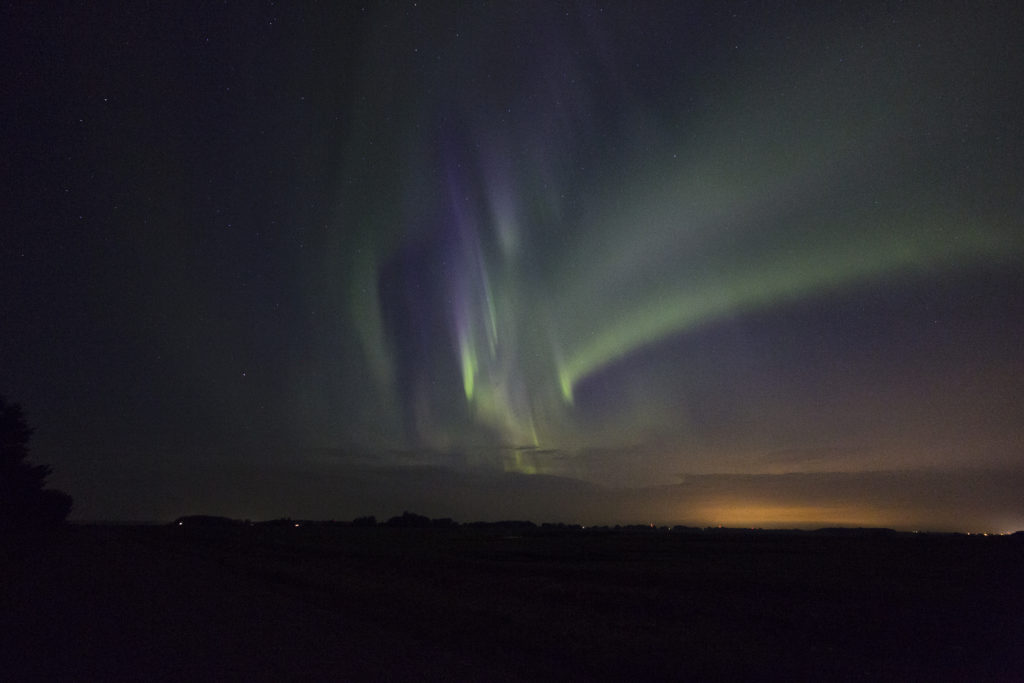
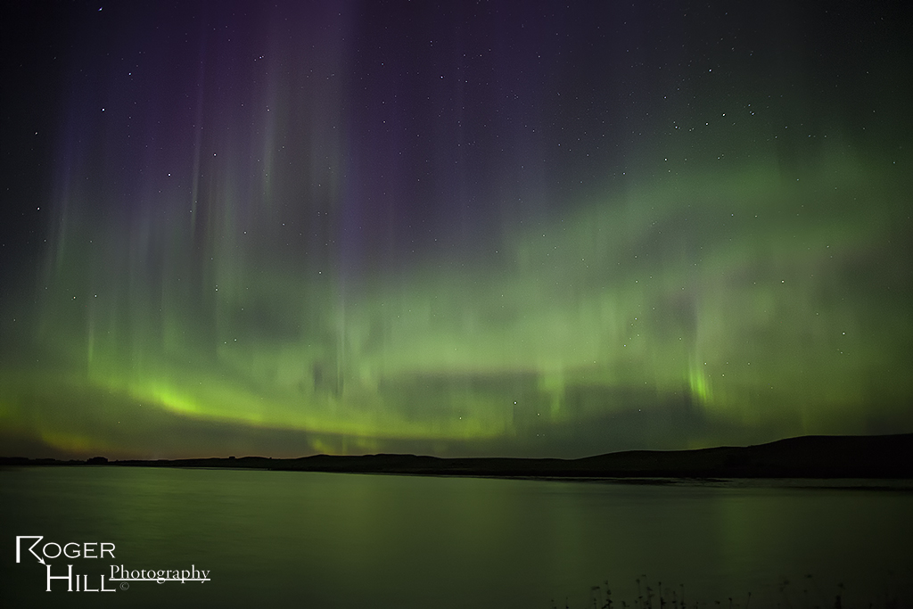
After our adventure in North Dakota on July 11th we knew we had to head well into Canada. A strong upper level low with great flow aloft, good moisture and instability, and lift along a dry line /Canadian Rockies foothills, would keep us in this region for several days. However, July 13th was by far the best set up in the area! We spent several nights in Red Deer, Alberta and chased west and north of there each day, capturing everything from supercells and tornadoes, great lightning, large hail, clusters of storms, and even a superb Aurora Borealis display on night!
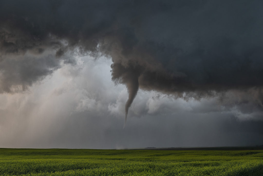
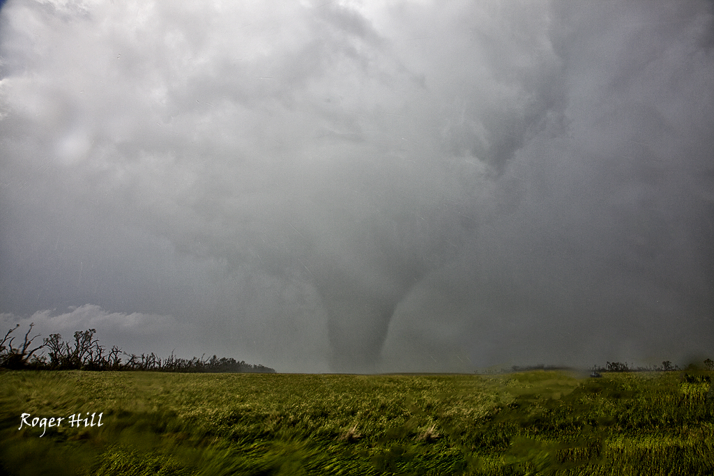
July 13th looked like the peak of action and it certainly was. We targeted a boundary and foothills intersection west of Drayton Valley and we were on the storm as it developed west of there by mid afternoon. We watched the storm cycle several times until it finally intercepted better moisture and instability and took off. It rapidly intensified and started rotating. Soon the roar of the winds with the RFD of the supercell could be heard, followed by the winds from the tornado it produced. It started as a multivortex and morphed into a cone before it completely wrapped in rain. It was rated EF1, the strongest tornado in Alberta in 2017. The storm had fantastic structure, and throw in the canola fields of Canada and it was stunning! A great day and 4 day period for us in Alberta. Beautiful countryside there! Enjoy the pics and the Aurora as well!
July 15th Regina, Saskatchewan, Canada Tornado Warned Supercell
We stayed in Canada for this specific day. Everything looked like a decent tornado event could unfold. Great shear, moisture and instability were in place for a fantastic event. Only issue, a weak cap. This would allow too many storms to form too quickly, which would mitigate the tornado threat. However, we did witness a very nice supercell that likely did produce a tornado that we just couldn’t confirm south of Regina.
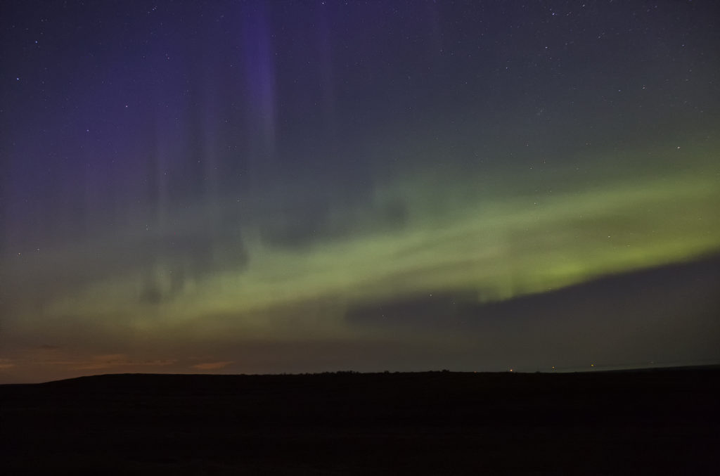
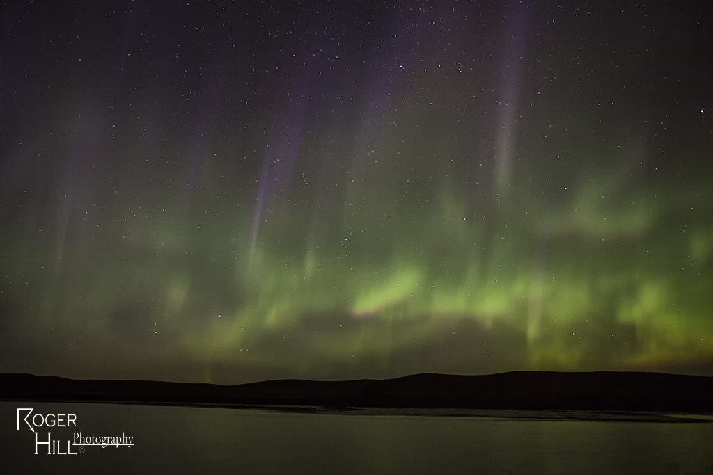
July 14th Southey, Saskatchewan, Canada Aurora Show
What a treat! One thing I love about chasing in Canada is the possibility of the Aurora making an appearance. This night it certainly did!
June 26th Parkbeg, Saskatchewan, Canada Strong Tornadoes
June 25th and 26th took us across the border to chase in Alberta and Saskatchewan. The trip resulted in my first ever Canadian tornado intercept. On June 25th we intercepted an HP supercell near Kindersly that had an amazing sunset under the gusted out storm. June 26th was the day to remember. An outflow boundary set up from southwest to south central Saskatchewan and become the focus for intense supercell development by late afternoon. The storm struggled at first and then spun like a top producing 2 photogenic tornadoes, with the 2nd one less than a mile from us and very strong. Amazing surface obs feeding the storm (82/77 with east winds at 20 mph) helped the base lower and ingest every bit of energy available. Check out the photos below. The first photo is from June 25th sunset. The rest are of the tornadic supercell on the 26th.
June 28th/29th, 2007 Montana and Alberta Supercells
June 28 and 29 took us to the far northlands of Montana and southern Alberta. June 28th’s storms developed near Glacier National Park and moved north near Conrad, MT. These storms were quite electrified and produced nickel sized hail.
On June 29th, we decided to head across the border to Canada and play supercells developing off the higher terrain west of Milk River and move northeast. We intercepted the prettiest supercell I have ever witnessed in Canada! It pummeled the border crossing with golfball to tennis ball sized hail and damaged many vehicles.
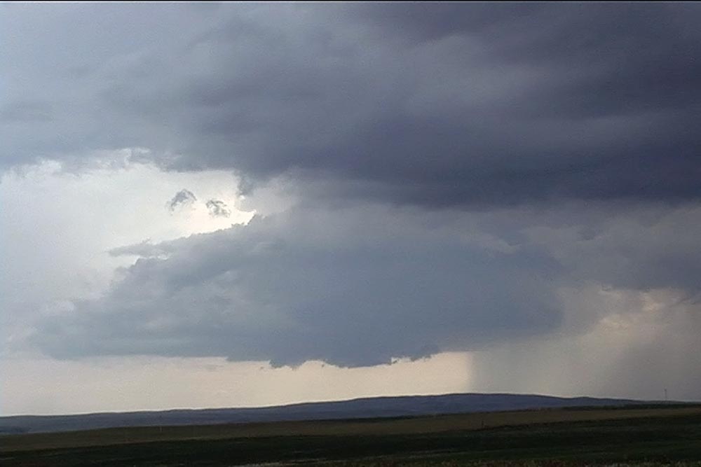
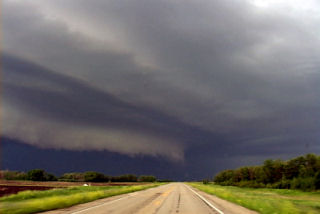
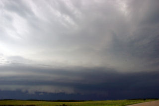
July 10th-17th, 2005 Canadian Prairie Images
The following images were taken while chasing the Canadian Prairie Provinces this summer. Beautiful country, but we did not catch a tornado. See the images below for our fun during this chase period!