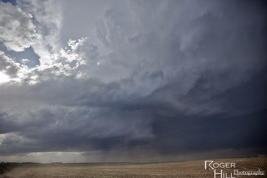
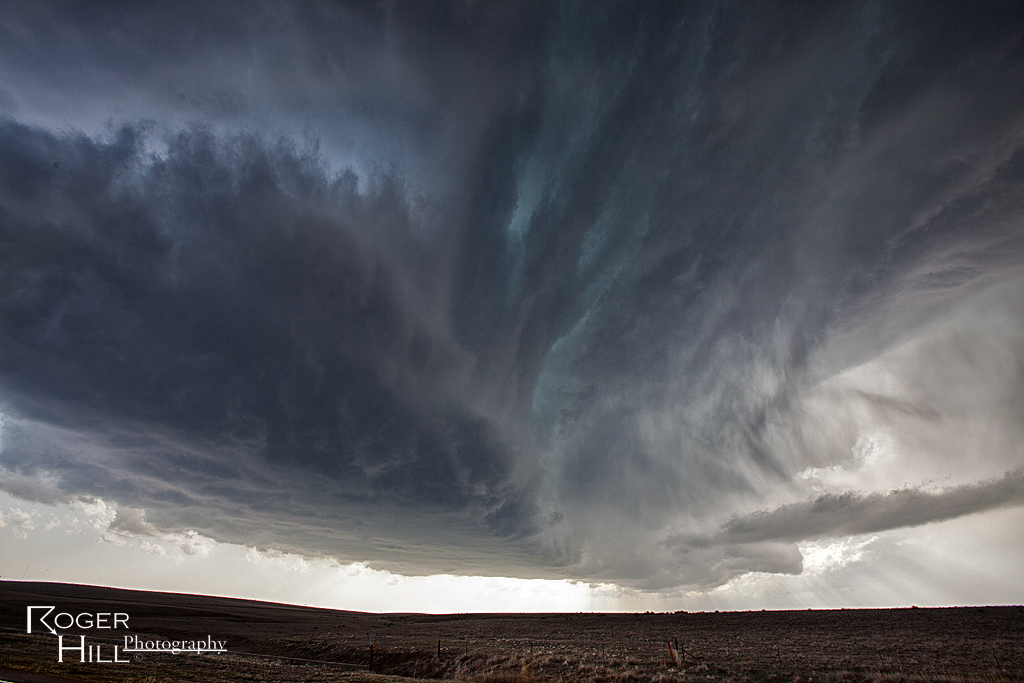
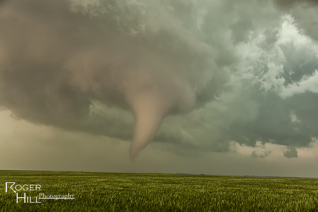
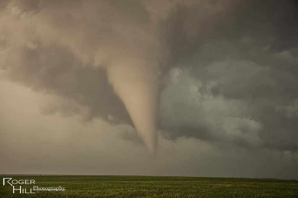
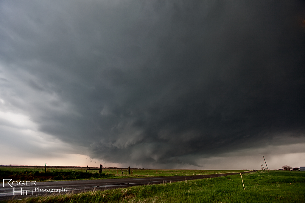
May 18th took Caryn and I to south central Kansas. We staged in Greensburg with the dryline immediately to our west. Hot temps and fairly low dewpoints had me initially concerned that storms would be high based and outflow dominant quickly. However, good shear and strong flow aloft I hoped would push storms quickly into better moisture and allow the bases to come down. We targeted storms coming out of the Oklahoma panhandle and soon found out those would not develop into much more than a line of high based hailers. Another storm, just northwest of Greensburg, started spinning from its initiation and we decided to blast back north to catch it as it ingested mid 60s dews. Fortunately we caught the tail end of the Rozell tornado and the entire life of the Sanford tornado. The first photo is of the Rozell EF4 tornado and the rest are from the Sanford tornado.
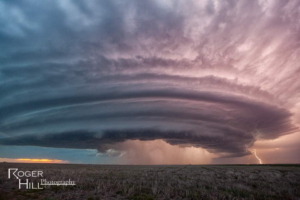
May 26th Central Nebraska Tornado Warned Supercell
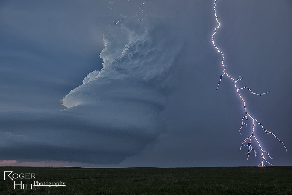
Wasn’t really confident in a decent storm on May 26th. Nature sure changed that though in a hurry! An intense, highly striated supercell formed northeast of Broken Bow, Nebraska and became one of the best structured storms of 2013. It was tornado warned for hours as well. The storm produced baseball sized hail and was also quite electrified in its lifetime.
May 9th Abilene/Menard, Texas Tornado Warned Supercells
May 9th set up looked decent with good shear, decent moisture, instability, and a dryline for convergence and initiation. Mid afternoon a supercell formed near Abilene, which became tornado warned. Quickly 2 other supercells formed to the south of the first, with a very intense cell near Ballinger and the tail end storm between Eden and Menard. The tail end storm became very powerful and produced copious amounts of hail baseball sized and was tornado warned for hours (although, it did not produce).
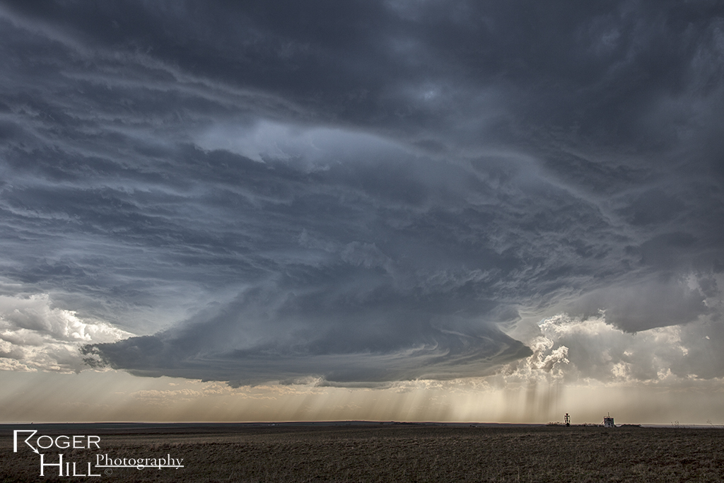
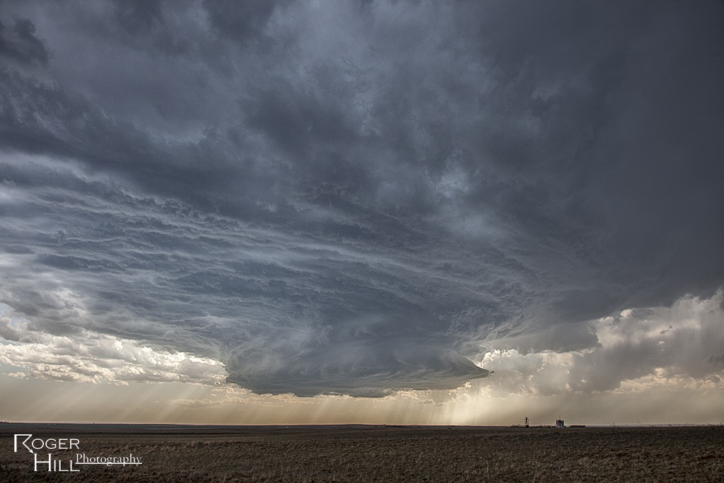
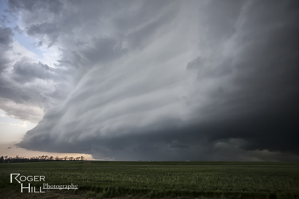
May 8th Protection, Kansas Supercell
May 8th featured a set up that was out of phase. Better moisture and instability was in Oklahoma, however better shear was in Kansas. We tried to find the best overlap of both, which looked like the Kansas/Oklahoma border area. A nice supercell formed late afternoon near Protection and tracked along a boundary until the cap strength increased, thus killing the storm.
May 6th East Central New Mexico Supercell
Wasn’t expecting much this day with low 50s dewpoints and modest shear, but ended up catching a decent supercell that lasted several hours. It had fairly good structure, produced a pretty gustnado and quite a bit of lightning near dark.
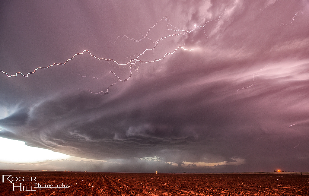
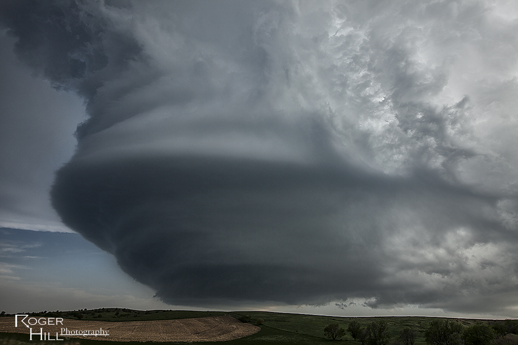
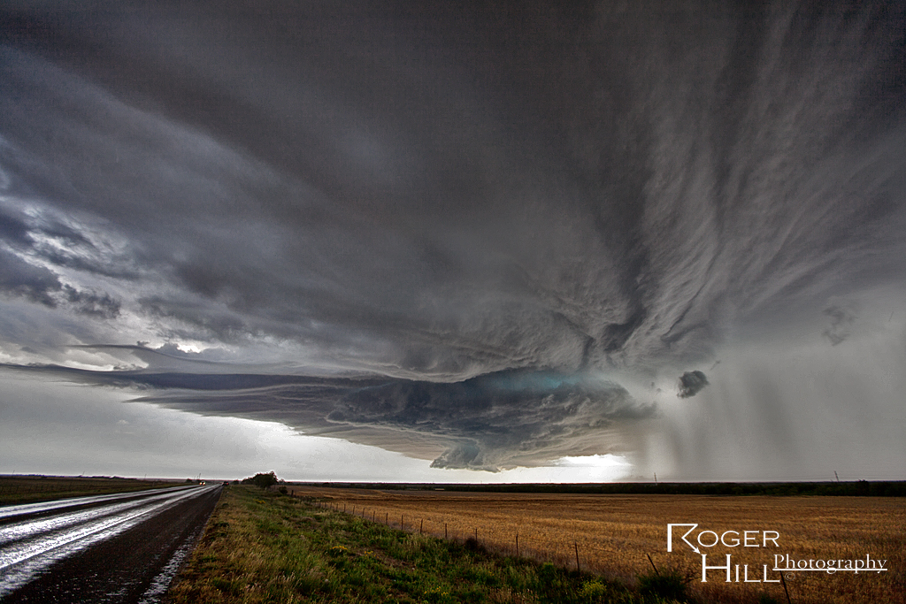
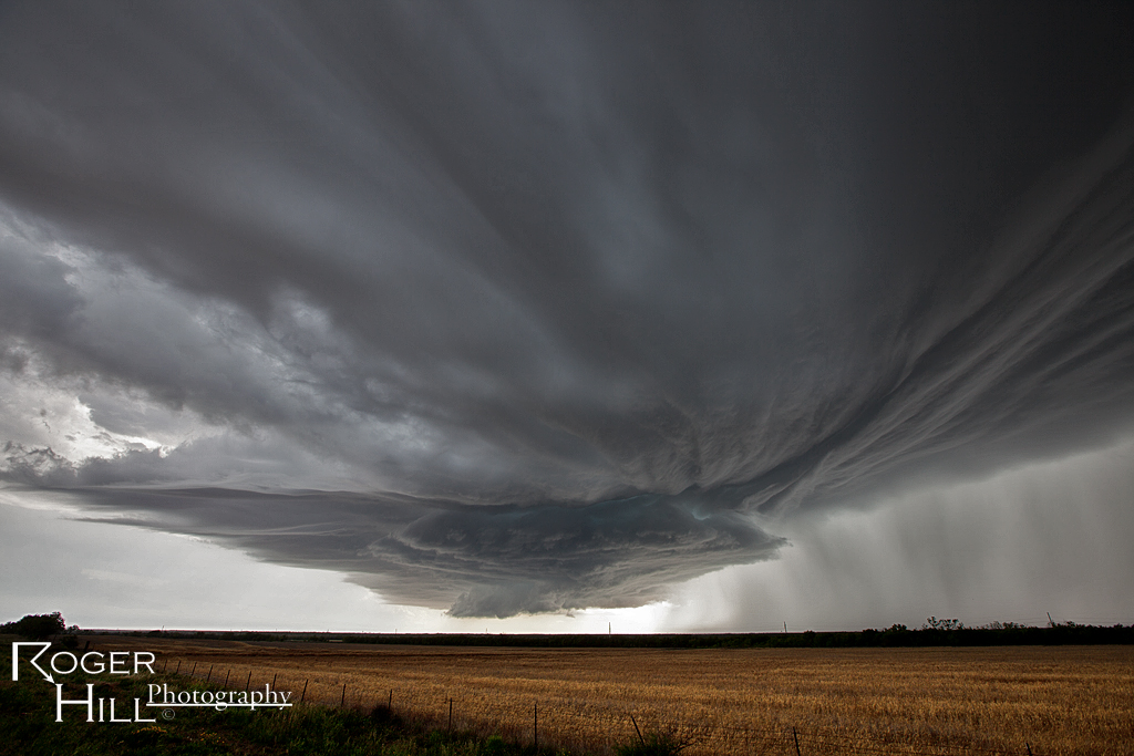
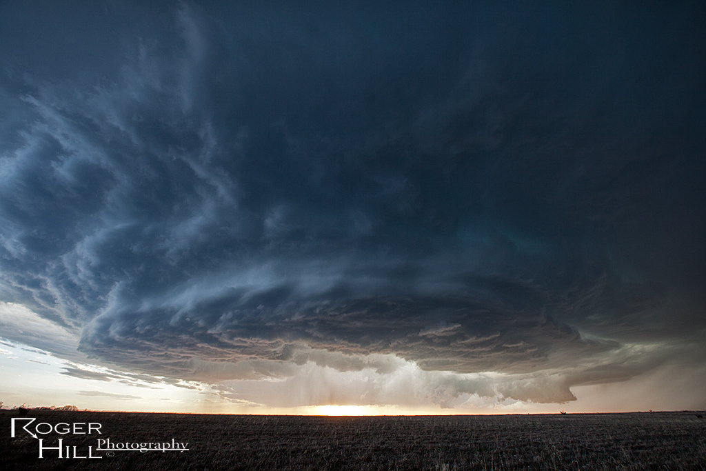
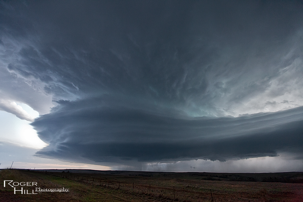
May 7th Central Kansas Supercells
May 7th had that typical early May feel in Kansas, with one exception, lack of moisture. Shear was fantastic, as well as a boundary for storms to fire on. By late afternoon one supercell formed that would be the storm of the day. It survived for about 7 hours and produced insanely beautiful structure, great lightning and copious amounts of hail. Had the dewpoints been in the 60s instead of mid 50s, it would likely have become violently tornadic. A fun chase and one of the prettiest storms of 2013 for me!
April 26th Western Oklahoma Supercell
April 26th was a surprise day for me. I wasn’t figuring on much happening, however nature gave us a pretty supercell west of Clinton that had decent structure, hail and was tornado warned, despite limited moisture and shear. Here’s a few shots of it.
April 17th Southwest Oklahoma Tornadic Supercells
The hype of April 17th didn’t live up to its billing. Only a few brief tornadoes occurred, and most were not very visible or photogenic. We chased a supercell near Lawton that produced a messy tornado in town, and then dropped south to the Red River of a near dark supercell that produced a small tornado before we could get there.
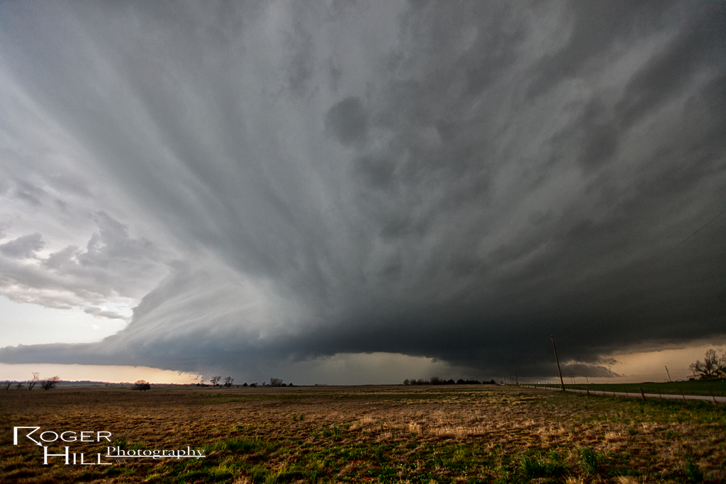
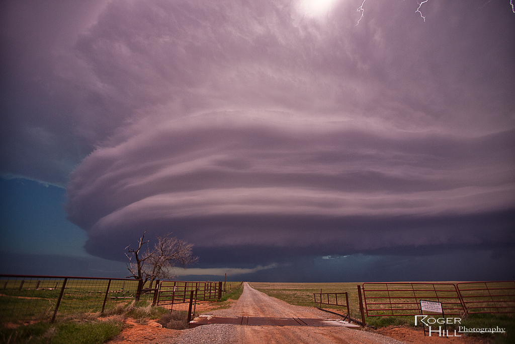
April 22nd Leedey, Oklahoma Beautiful Supercell
April 22nd took me to northwest Oklahoma to play a dryline/cold front intersection. A couple of intense supercells formed near Enid and northward across the Kansas border, but we waited till the dryline storms formed by early evening. A magnificent supercell formed southwest of Woodard, and turned moving southeast towards Leedey. The structure of the storm was simply stunning, with the best photography occurring just as dusk as intercloud lightning illuminated the highly striated updraft!
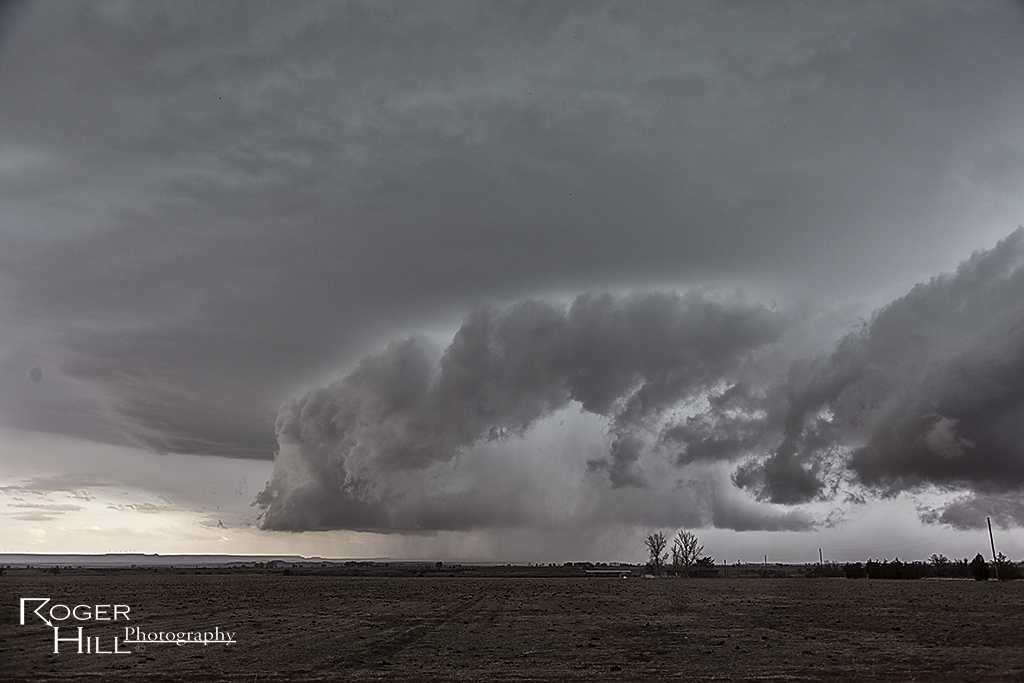
April 8th Eastern Colorado Supercell and Weak Tornado
April 8th took me to the I-70 corridor near Flagler and then northeast to north of Burlington, Colorado. A high based supercell formed in a high shear low CAPE environment and struggled as it moved northeast, often coming close to dissipating before restrengthening again. Storm structure was decent and eventually the storm produced a brief, weak tornado north of Burlington.