
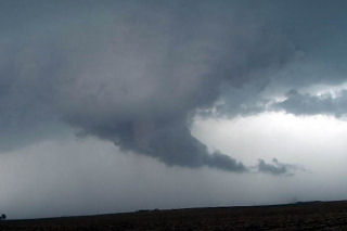
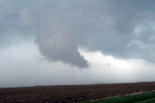
May 8th, 2004 Dallas County, Iowa Tornadic Supercells
This day took me to Iowa for high based supercells. The set up wasn’t ideal with only low to mid 50’s dewpoints with temps in the mid 80’s. By mid afternoon convergence along a west/east oriented boundary would be the focal point for severe thunderstorms where moisture pooled along the boundary. Storms fired in Green county and back built and moved southeast into Dallas county. This storm produced 2″ diameter hail and had decent structure. During its first cycle, it produced a weak tornado for about 1 minute. Later when it went HP, it had a very nice rotating wall cloud. Finally it lined out around 9:30 PM and moved south of Des Moines.
No comments yet.