
May 23rd Southeast Colorado Supercell and Tornado
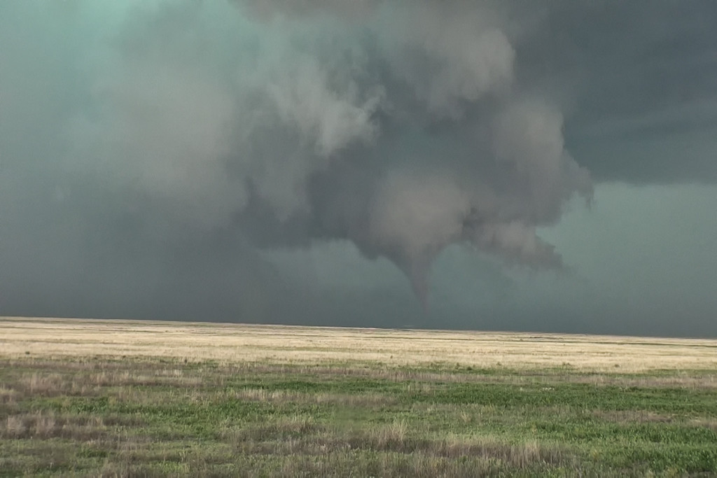
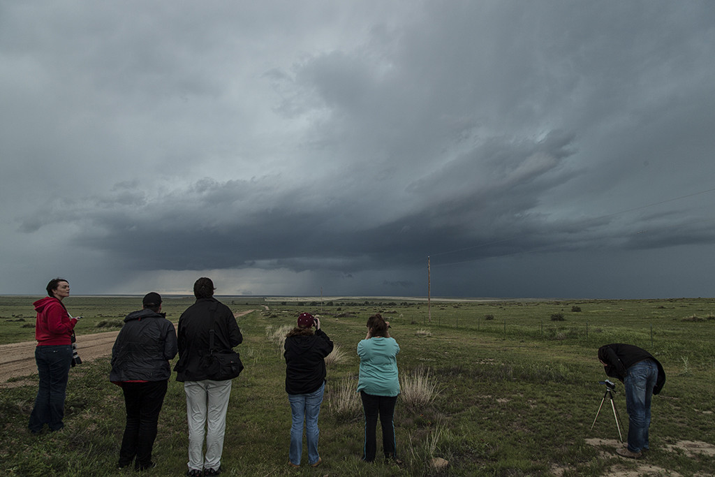
High CAPE, good shear and lift along a boundary would provide the focus for severe storm development on May 23rd. We arrived south of Lamar early afternoon as storms formed quickly, and became severe. An anchored supercell southwest of Lamar did everything it could to be the storm of the day (which is was). Constant new cell development on its flank resulted in the storm mode being messy. By mid afternoon, though, it managed to pull off the anchored spot and move northeast. The storm had incredible structure, HUGE hail and finally produced a weak tornado. Structure was the main thing this day and it certainly did not disappoint!
No comments yet.