
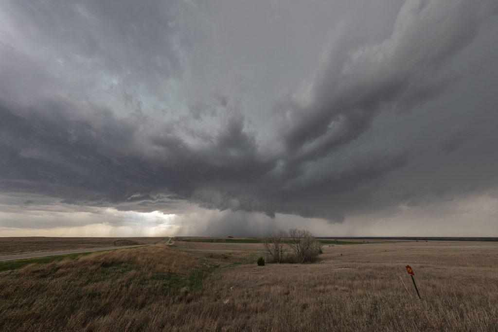
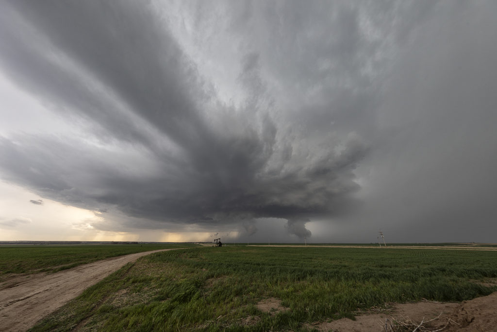
May 1st Kansas Tornadic Supercells
May 1st had a lot of promise. However there were certainly some issues with the set up. Storm mode was unclear near the front in northern Kansas and a strong capping inversion southward along the dryline could result is very short storm lives in that area. We started near Great Bend and jumped on a storm that formed northeast of Dodge City. It quickly became tornado warned. Based on initial visuals of the storm, it had little tornadic threat at that time. As the storm moved northeast towards Interstate 70 it really ramped up, getting tornado warned for nearly 3 hours. Rotation was visibly increasing and the structure of the supercell became quite nice. Unfortunately a left moving split further south came crashing into it and basically killed it. Other storms formed north and south, and opting for the usual tail end storm this day proved to be the wrong play. As the tail end supercell moved east away from the dryline, it showed a nice hook on radar and became tornado warned. As we raced south, leaving the messy northern play to get on the tail end storm, it weakened and eventually died. Before dying, it gave us a very nice look at the updraft as it became a low precipitation supercell. 9 out of 10 times this play works. However this day it did not as a cluster of storms north of the interstate rotated and one dropped a significant tornado.
Enjoy the photos as it was a pretty supercell!
No comments yet.