
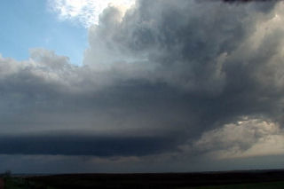
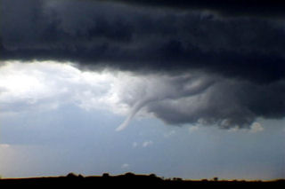
June 6th, 2004 Max, North Dakota Tornadic Supercell
This was a tough one for me. We left Denver early this AM with a target of Dickenson, ND. After almost 800 miles, we arrived to see 3 high based storms get their act together. Strong moisture return ahead of a short wave trough would provide lift to get these storms going. In spite of only upper 50s dewpoints, these 3 storms turned into supercells, with the southern storm, near Max, ND our target. We arrived as the storm was a beautiful saucer base with clear slot. A couple of funnels formed and extended close to the ground. Close enough I would consider this tornadic.
No comments yet.