
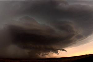
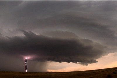
July 20th, 2006 Goshen County, WY Supercell
July 20 promised to be a day with decent shear, instability and moisture, with a strong wave moving southeast out of Montana late in the day. Morning cloudiness cast a doubt on anything decent happening, but by noon, the mid level clouds eroded and good surface heating commenced. It didn’t take long for storms to fire up, and this storm became the storm of the day, producing tennisball sized hail, at least two funnels and intense lightning. It developed along I-25 south of Chugwater, WY and dissipated along the WY/NE border. It was one of the prettier storms of 2006!
No comments yet.