
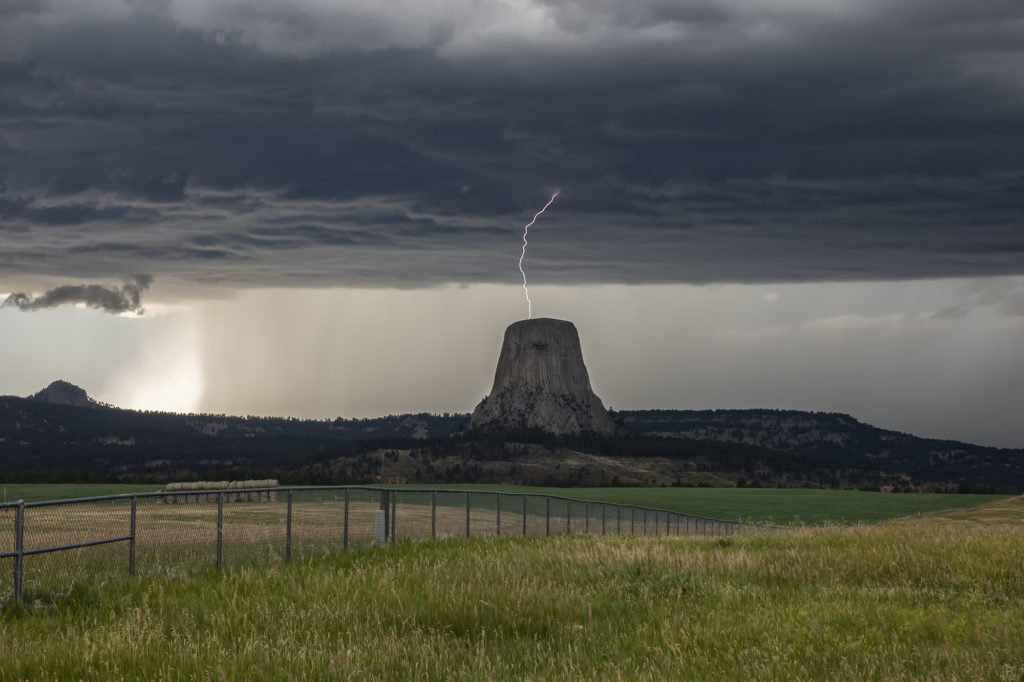
July 19th Devil’s Tower, Wyoming Beautiful Supercell
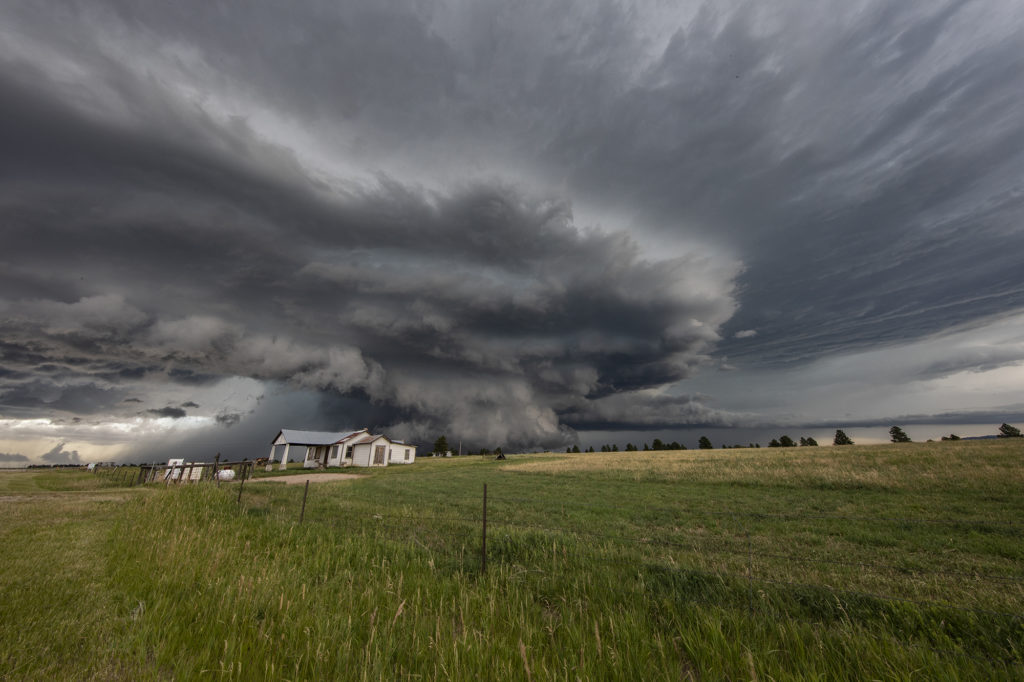
July 19th was a spectacular day! Good moisture, high instability, good wind shear and a boundary along the Wyoming/Montana border would set the stage for intense supercell development. One such storm formed northwest of Devil’s Tower and drifted southeast. As it crossed Devil’s Tower we had quite the lightning show! I managed to capture a bolt hitting the top of the tower! As the storm moved southeast near Sundance it became extremely electrified producing a CG every 3-4 seconds! At one point, it had an appearance like it was ready to produce a tornado. We lost visibility in the hills and could not confirm one way or another if it did. Later, a second supercell tracked southeast from near Buffalo, WY down to Lusk, WY. This storm constantly spun hard, had pretty structure and was also tornado warned numerous times! It’s structure was top notch and had various rotating wall clouds throughout it’s life. But, as continued to be the theme for 2020, storms had great structure but just couldn’t produce significant tornadoes. Overall it was my favorite day in July for chasing, and one we captured some incredible photos! Enjoy!
No comments yet.